Hi,
After installing the Sen4Cap on Centos 7.9 successfully, I tried to load the sample shape file provided by the official Sen4Cap site ( which is based on Netherlands) and the file loaded successfully. Now I want to test the software on my desired location which is out side the Europe area.
My question is:
Where to find or download the shape file of the desired site extent?(by country) I would appreciate if you give me some websites’ links so that I manage to upload my shape files. I tried some websites and downloaded the desired shape file but the Sen4Cap did not accept the “.zip” file and an error occurred.
The best
I even tried to use the help of this link “Sen4CAP/FAQ.md at master · Sen4CAP/Sen4CAP · GitHub” related to " Shapefile uploads don’t work" topic but the desired shape file uploading error did not solved. I just want to download a healthy shape file of the desired location then test it on my software.( I could upload the official sample shape file successfully so I think the problem could be because of the downloaded file.)
Hi herald.tom,
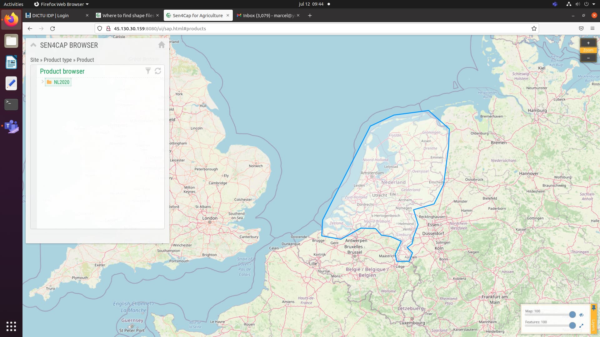
There are two shapefiles which you need in relation to the area you want to investigate. The first one is a boundingbox of the area under investigation. You can use qgis for example to draw a rough outline of the area. Just make sure that it doesn’t have to many points. For The Netherlands it looks like this:
The second shapefile should contain the parcel boundaries of the area under investigation. Usually these are fields declared by farmers in order to get subsidies. These boundaries usually delineate an area of grassland, arable land or a field with permanent crops. See the examples below:
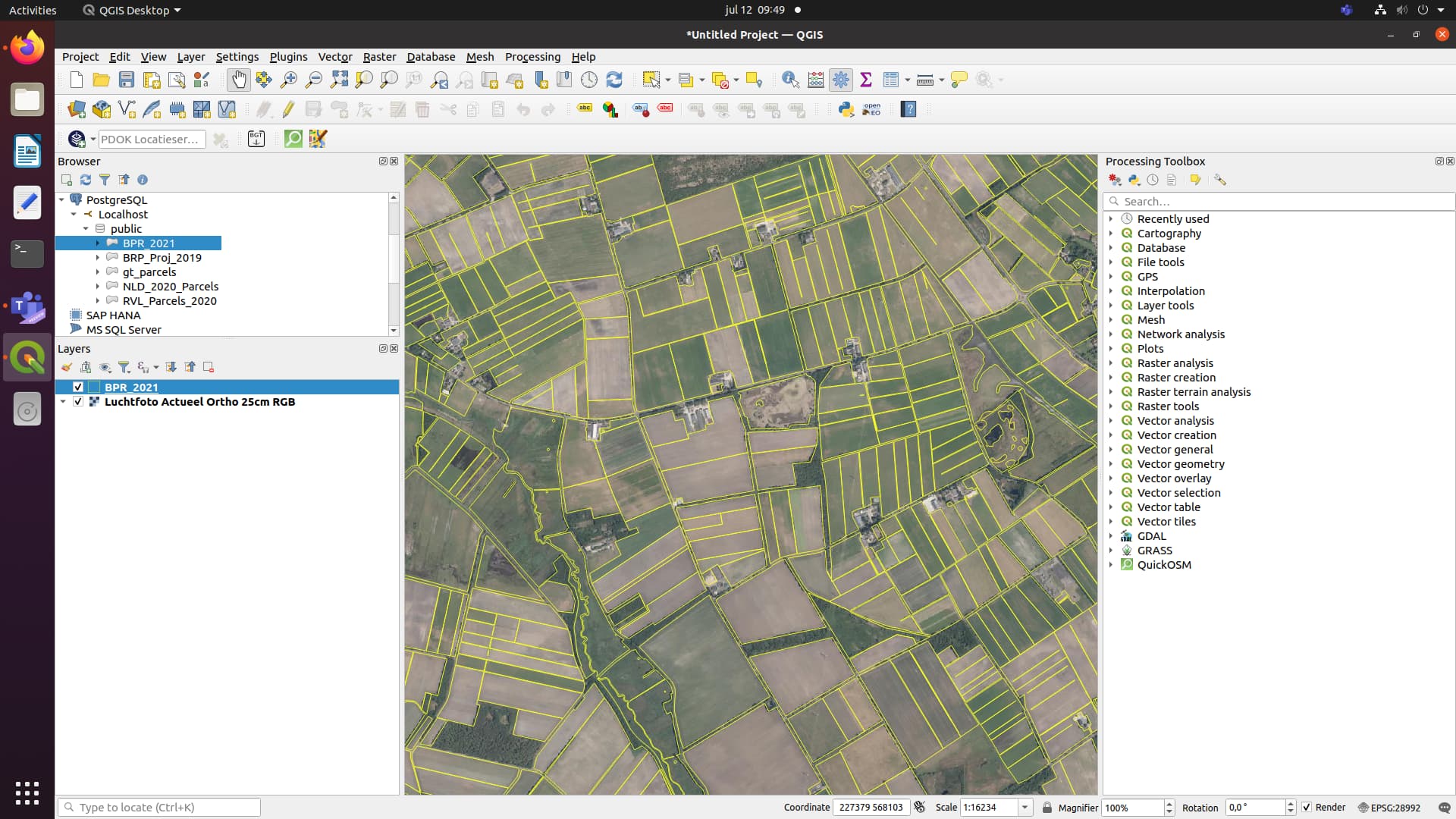
The second shapefile should at least contain a unique identifier for each field, the crop which is cultivated on the field (usually declared by the farmer) and a unique identifier for the farmer.
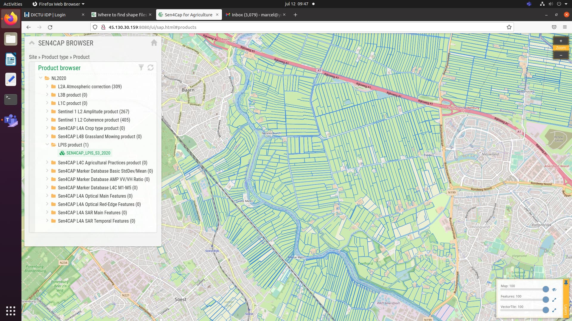
You also need a list of all the crops cultivated in your area of interest. The so-called LUT file. Some countries make this information publicly available, but not every country. In Europe more and more countries are making there crop parcels publicly available. You can find some of them on
https://data.europa.eu/data/datasets?query=lpis&locale=en
But outside Europe it’s difficult for me to tell you where you can find similar information. Maybe you can contact your national ministry of agriculture. They might even be interested in what your are doing.
Best regards,
Marcel
Thanks @marcelmeijer for your time and explanation. I would be thankful if you tell me how to feed all these files into Sen4Cap. (I thought that we just need 1 shape file to feed for site defining process so I think your explanation for feeding the 2 shape files( included the bounding box and the parcels) and the “LUT” file would be so good).
Regards
There are several version of Sen4CAP below you will the links to the different manuals:
Version 3
You can find more information in the manual (starting page 43):
http://esa-sen4cap.org/sites/default/files/Sen4CAP_System-Software-User-Manual_v3.0.pdf
Version 2
You can find more information in the manual (starting page 44):
http://esa-sen4cap.org/sites/default/files/Sen4CAP_System-Software-User-Manual_v2.0.pdf
Version 1
You can find more information in the manual (starting page 40):
http://esa-sen4cap.org/sites/default/files/Sen4CAP_System-Software-User-Manual_v1.1.pdf
There are also some interesting video’s from Sen4CAP which might help getting a better understanding of the use of the system:
https://www.youtube.com/channel/UCPxn7JUmEOF3feJZIZob8YA


Unfortunately they don’t address possible issues you might encounter during the use of Sen4CAP but this forum is a good place to start if you encounter specific issues.
Hope this helps!
Marcel
Thanks again for your response.
The best